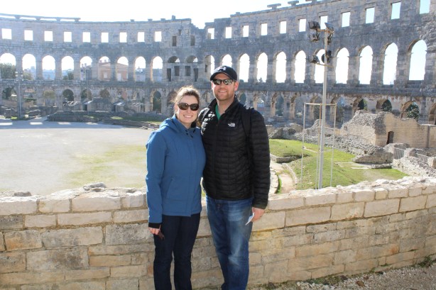
Colosseum (Pula, Croatia). The most well preserved Colosseum outside of Italy.
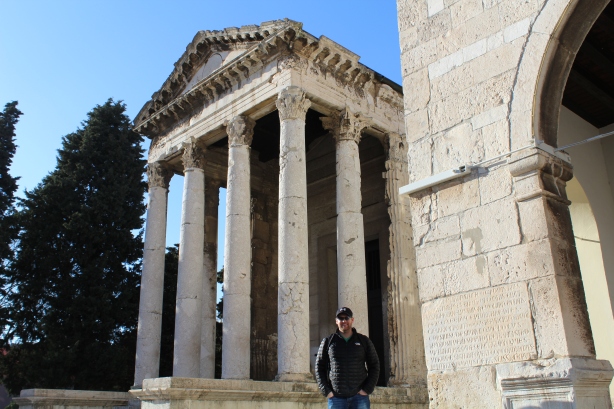
The Temple of Augustus (Pula, Croatia). Built between 2BC and 14AD for the Emperor Augustus Caesar. The Latin plaque beside be reads “To Roma and Augustus Caesar, son of the deity, father of the fatherland”.
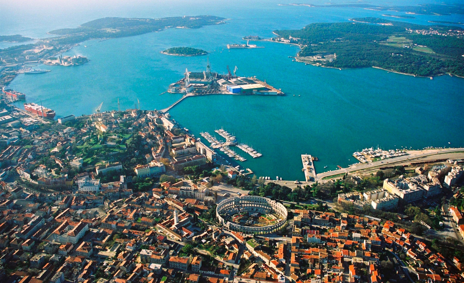
At one point. This entire area was part of the Roman Empire – which means that Roman ruins are dotted throughout the region.
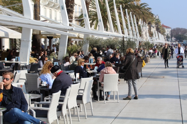
Cafes/coffee
Cafes near old town (Split, Croatia)
As a local put it “coffee in Croatia is like a second religion”. As we found out, it’s not only Croatia. Coffee is a second religion in much of the Balkans. People will spend hours sitting at a cafe socializing over a cup of coffee. Of course, the coffee’s are strong and tiny (as they are in all of Europe). Meg and I are dying for a large Tim Hortons coffee when we get home.
Smoking
“I don’t smoke – it’s a disgusting habit”
Well….. this isn’t one we will miss but we couldn’t leave it out! Meg and I were shocked at how many people smoke in the Balkans. In Bosnia, it’s nearly 50%! In many places it’s still legal to smoke in restaurants and bars so their was a plume of smoke in many of the places we visited. In fact, every country we visited ranks highly on the list of countries that consume the most cigarettes.
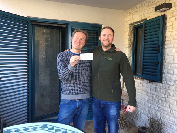
This trip has been exceptional as far as our Bed and Breakfast hosts. They have went above and beyond for us time and time again. Most times they would greet us with a welcome drink when we arrived, and they would do absolutely anything they could to make our stay more enjoyable. I can’t say enough about them.
Sauerkraut/Sausages
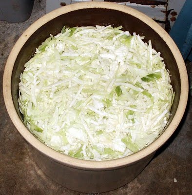
No Balkan market would be complete without sausage and sauerkraut. It seemed to me that most local markets we encountered had someone soaking shredded cabbage in a barrel to make sauerkraut.
Making sauerkraut
Likewise, it seemed to me that sausages or thinly sliced meat were a much more popular meat than say steak or pork chops.
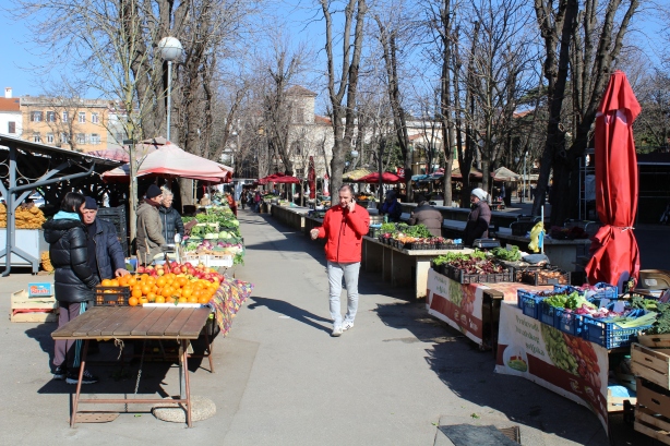
Markets (Local grocery shopping)
As a general rule, I would say that most people in the Balkans shop at small, local, fresh markets instead of big box stores. I would also venture a guess that most items in their diet are produced within a 200km range of them. This is partly due to the climate in this region (which allows them to grow nearly everything).
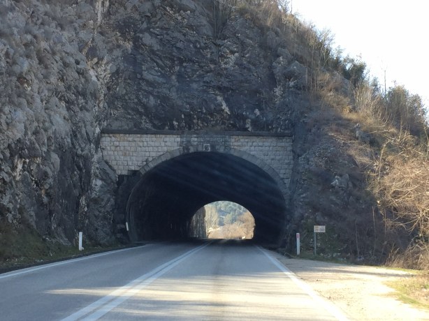
Tunnels
I’ve never driven through more tunnels in my life. Dozens of them. The longest one we drove through was 6km long.
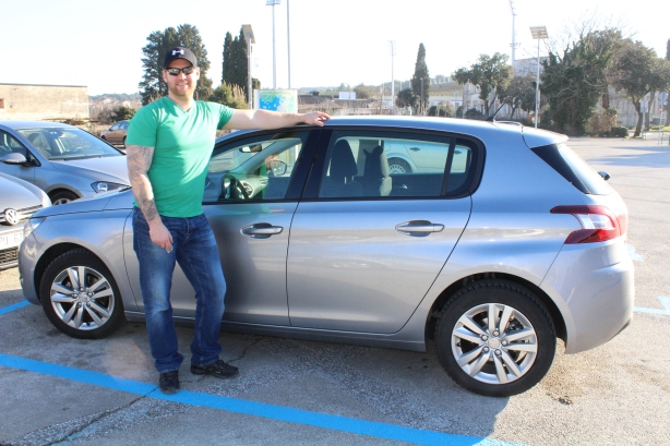
Our ride: a hybrid Peugeot 308
After 1500km on the old rental car (which is a lot for Europe), it was time to say goodbye to it this morning.
We are now spending our last 3 nights in London before jumping across the pond to get back to reality.
“Jason, what the hell are we doing here?” Megan asked as we took our freshly stamped passports from the Bosnian border official and crossed the Bosnian border in our hybrid “golf cart” of a rental car.
Driving from Split, Croatia to Sarajevo, Bosnia
She wasn’t saying that because we were in Bosnia. She was saying it because we were in the middle of the Dinaric Mountains on a road barely wide enough for two cars to meet …….in the middle of a snowstorm. White knuckle time.
I can hear you saying: “But Jason, you are in Europe, how bad can a snowstorm possibly be?”
Pretty dang bad is the answer.
Pic we snapped from the rental car after the storm.
Tough to believe that only a couple hours earlier we were drinking coffee outside in a T-shirt in Croatia.
The 240km drive took us 6.5 hours as we navigated the storm. I’m not gonna lie – it was the most stressful drive of my life.
But we FINALLY MADE IT TO SARAJEVO!
What do we know about Sarajevo?
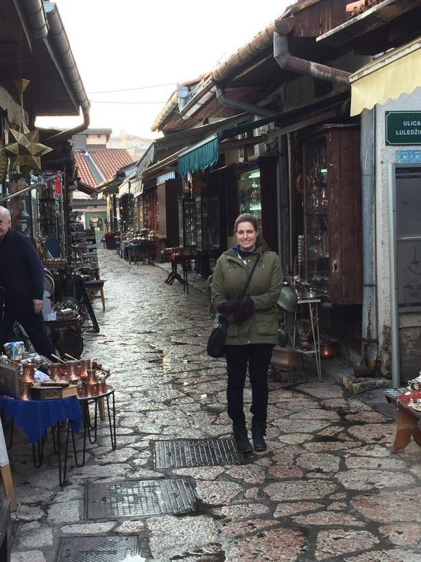
Coppersmith Street
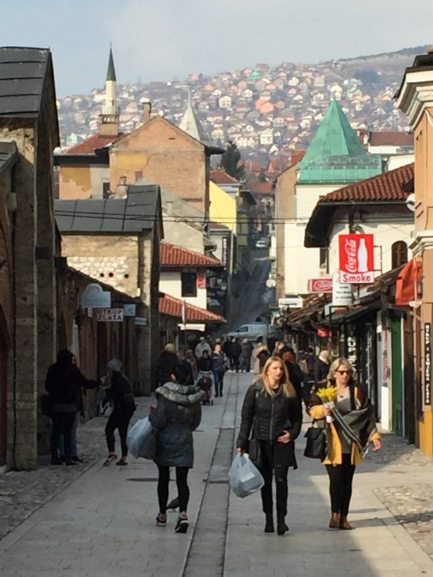
Old town
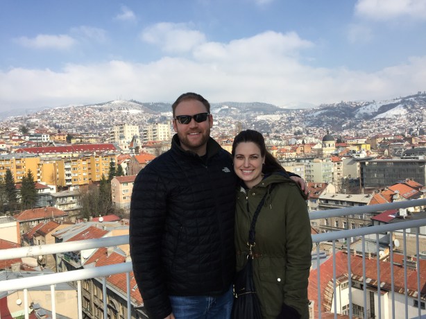
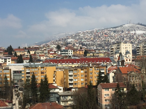
View of the skyline
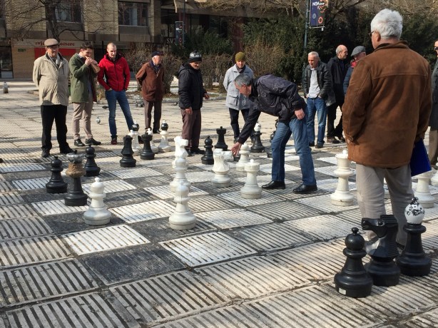
Old men ridicule each other during a game of giant chess in a town square
Sarajevo is built in a valley with large hills on all sides.
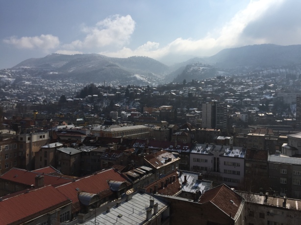
View from a 9th floor cafe
It’s the capital and largest city in Bosnia and Herzagovina (about 700,000 people). The entire country has only 3.5 million people.
The mixed ethnicities mean that the politics are complicated – each ethnicity elects a president and the three presidents must work together. Bosnia may have the most complicated political system I have ever heard of….. I’m not even going to begin to explain it.
The unemployment rate is 43-45%
Nearly everyone smokes
The country has tons of potential but still has not economically recovered from the Bosnian War (1992-1995). More on that later.
Now let’s get to the good stuff….
The Food
Here are some of the local foods we’ve been sampling:
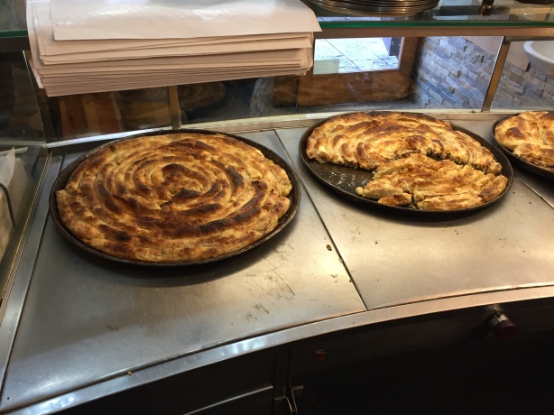
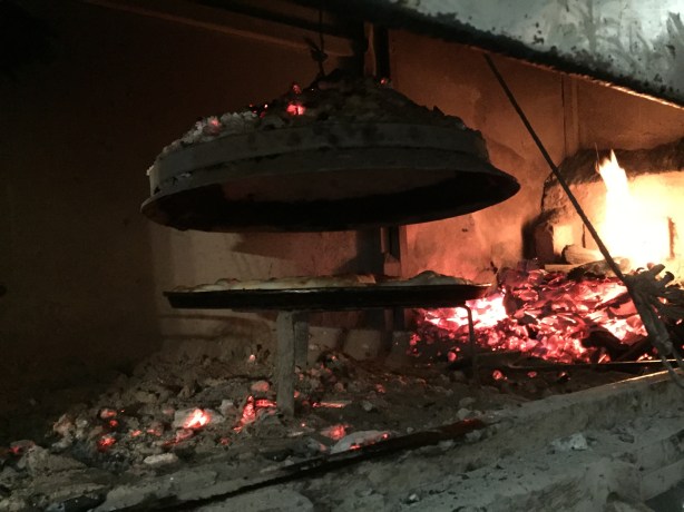
Burek. A layered pastry stuffed with minced meat, cottage cheese, spinach, potatoes, and other fillings.
The chef let me come see how they make burek. Hot charcoal is placed on top of a press which is then lowered down on top of the pastry.
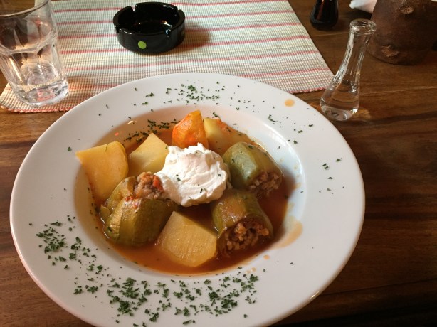
Punjene Tikvice. Stuffed zucchini: ground beef, rice and spices are combined and baked in a hollowed zucchinis.
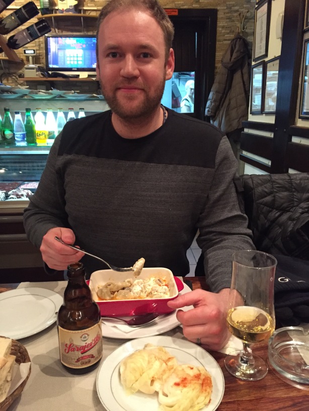
Klepe. Bosnian minced meat dumplings. The beer is Sarajevsko (excellent local beer)
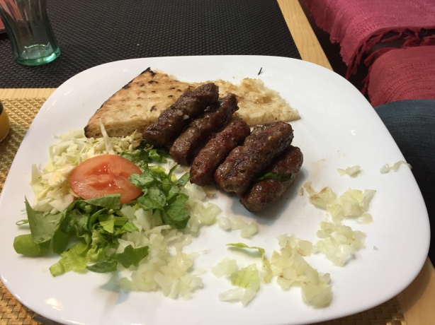
Cevapi. Rolled lamb and beef served with fluffy pita bread and vegetables.
OK. This blog is getting way too long and I need a brewski to finish. To be continued……
Note: This is the second blog post today since we have just got internet.
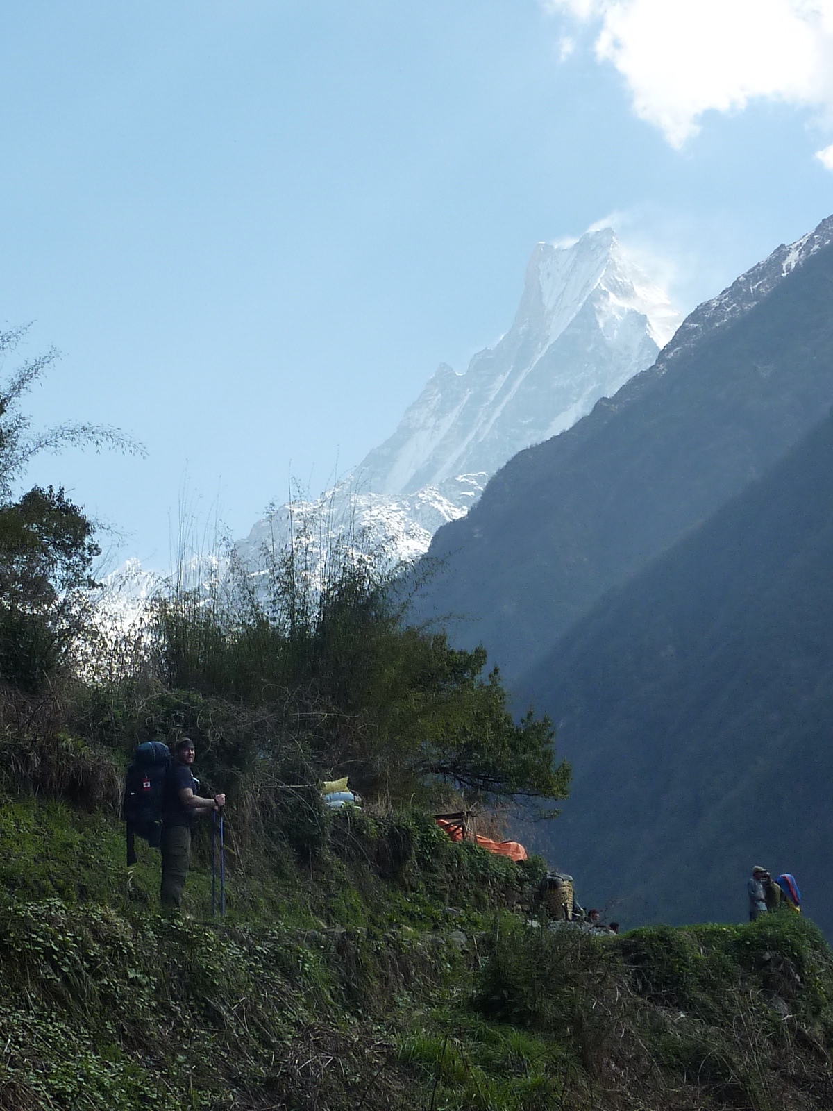
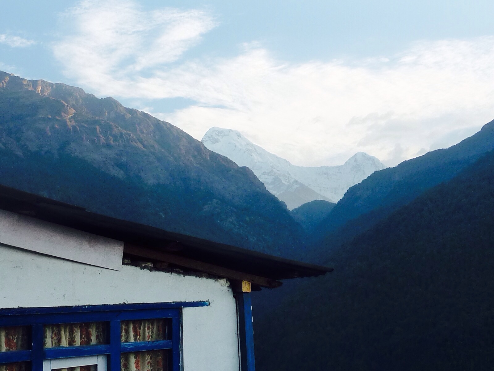
Day 5 (Sinuwa to Himalaya)
Starting elevation: 2360m
Oh the land, it is a changing
The day began with a tough uphill slog for an hour. On these type of inclines, we try to take a 2-3 minute water break every half hour before carrying on. The trail is starting to look much different the further into the mountains we get. For one, we no longer pass barnyard animals on our treks – hence why we cannot eat meat this far into the mountains. Also, the trail has become much smaller and instead of having nice steps to climb, we have a much more rough trail. Rocks are roots are scattered about the trail making for much more debris to step over.
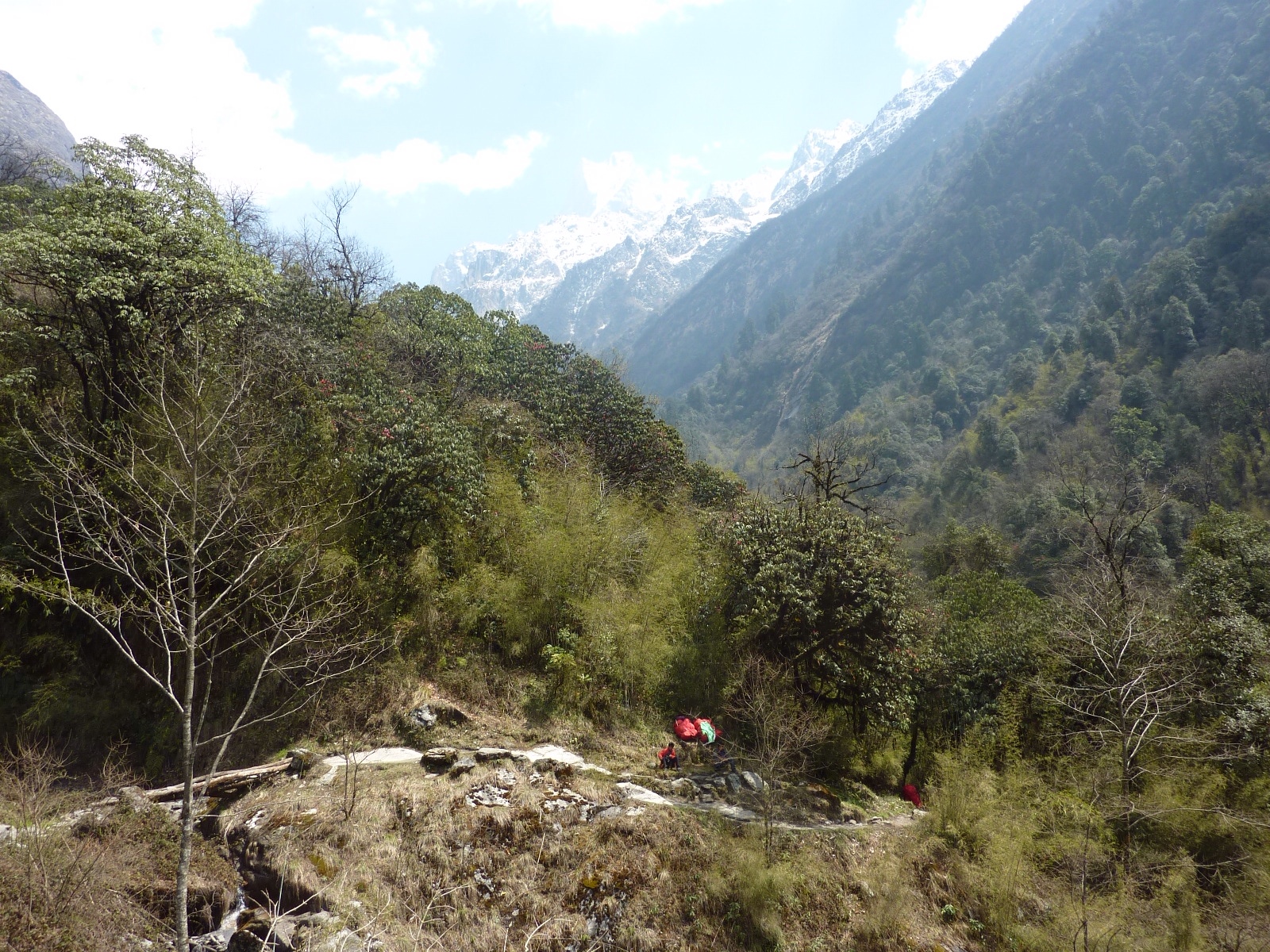
From there the trail wound throughout several valleys, and crossed multiple small steel bridges along the way.
After 3 more hours of rollercoaster hiking (up, down, sideways, etc.) we settled down for a tuna-cheese-spaghetti and veg noodle lunch in the small village of Dobhan.
Another thing we've noticed as we get further back in the mountains is that villages no longer appear very half hour. Instead it's 2 or more hours of hiking in between villages. After lunch signs informed us that we are getting into holy land and that spitting and pooing outdoors will no longer be permitted.
Where's my Immodium?
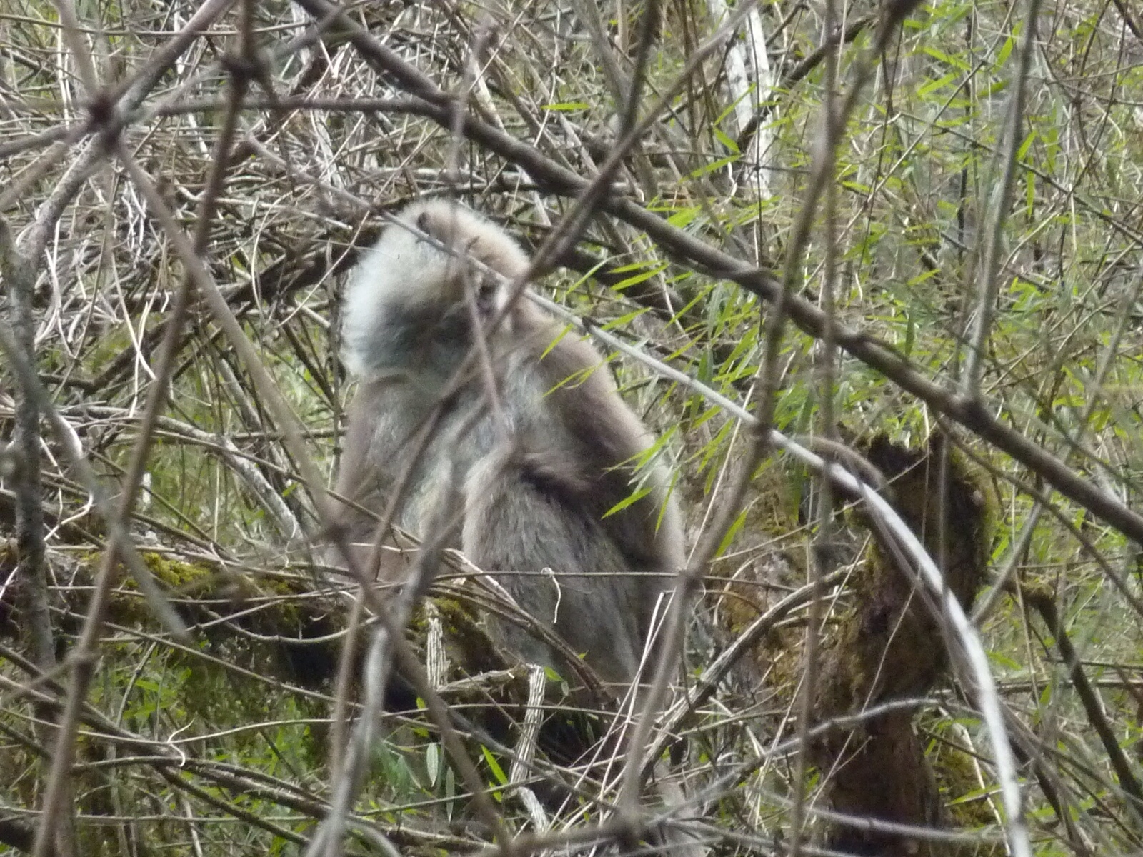
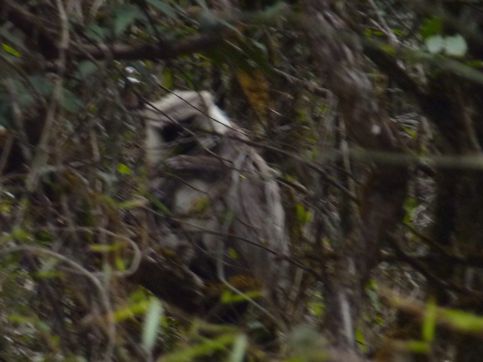
A half hour before the end of our hiking day we spotted a group of grey furred monkeys hanging out in the trees just before the village of Himalaya. I tried to capture some good pics but the damn things are so elusive.
Literally less than one minute after reaching our destination (the small village of Himalaya), it started raining buckets and then hailing buckets.
Total trekking time today: 6 hours
Tomorrow we start our last push to get to base camp!
Day 3 ( Ghorepani to Poon Hill to Ghorepani to Tadapani)
Starting Elevation: 2860 meters
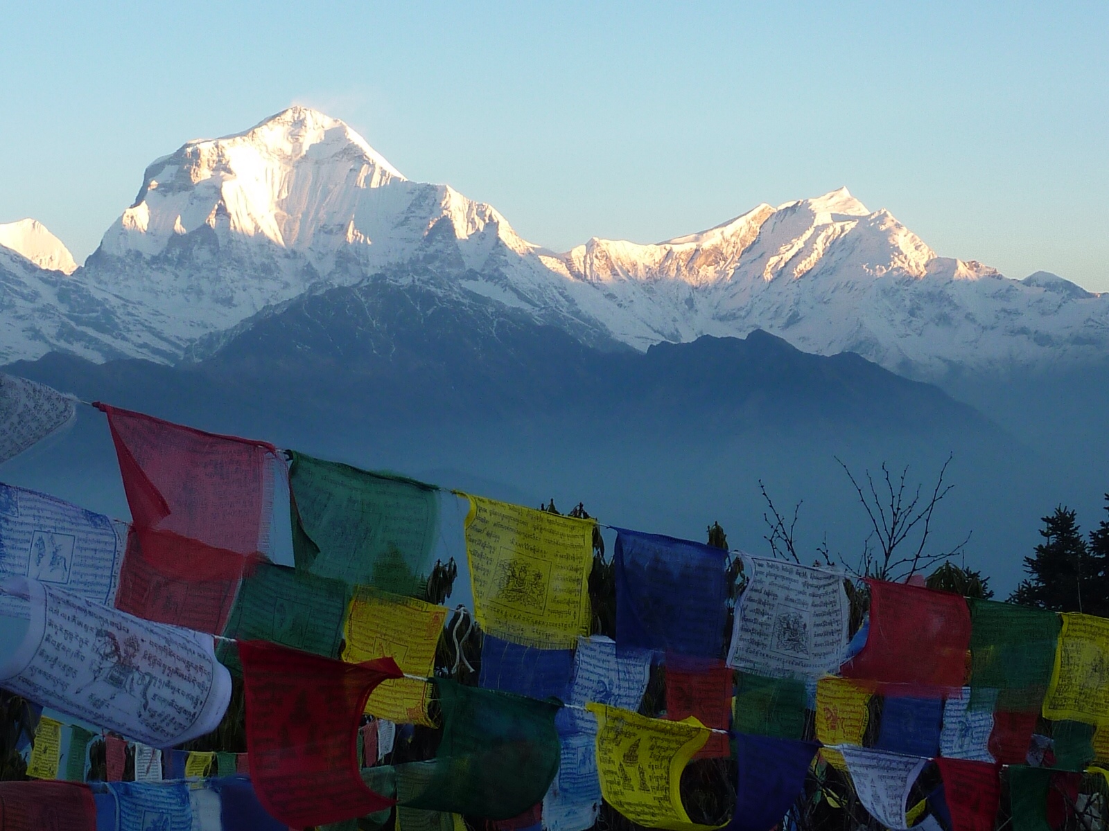
The day started off at 5AM. We donned our headlamps and started the ascent to Poon Hill. Poon Hill is a viewpoint only an hours hike from Ghorepani. The objective is to get to the viewpoint in time to watch the sun rise overtop of the Himalayas. The steep incline made sure that both Megan and I were sweaty messes by the time we reached the top. But it was worth it.
I was quite surprised at how many people made the one hour early morning hike. I would have to say at least 175 people were on Poon Hill in time for the sun rise.
People scrambled to find the best possible place to capture the sunrise with their expensive cameras with lens's as long as my arm. I suppose all the ruckus took away from the serenity of it all, but nonetheless the views were quite amazing once the sun starting cresting the mountain tops.
Megan and I in front of Dhaulagiri mountain (8175m). 8th highest mountain in the world.
The coloured paper behind us are Buddhist prayer flags and can be found at most important sites in the mountains. Buddhist believe they give good fortune when the wind blows through them.
Someone was actually selling hot tea on Poon Hill which was a nice treat before we had to retreat back down the hill to Ghorepani to pack our bags, have a quick breakfast, and continue on our way to ABC.
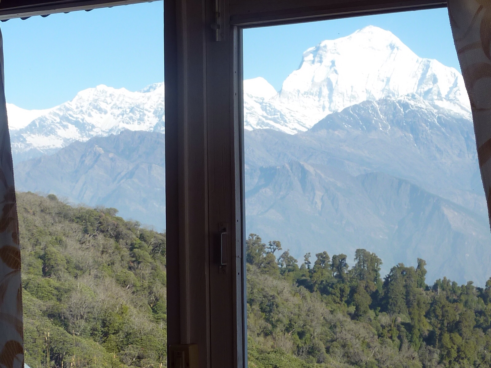
Enjoying the view from our guesthouse window before hitting the dusty trail again
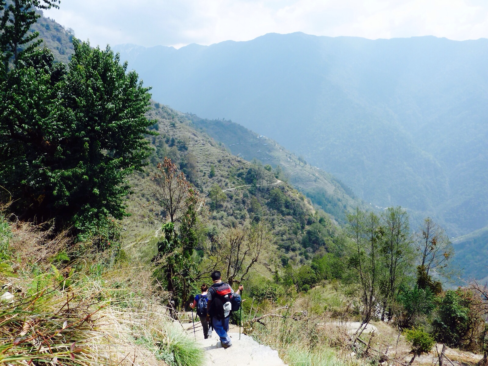
As the hike started, we quickly found ourselves climbing steadily again for an hour or more until we had gained another 450 meters in elevation and had another beautiful lookout over the landscape.
The trail eventually levelled off where we enjoyed a modest incline or “Nepali flat” as our guide calls it. After 4 more hours of ups and downs we ascended a sharp incline for 45 minutes before reaching our destination of Tadapani.
Tadapani was a tiny little village with a brilliant view and a crappy guesthouse. Our guide suggested we stay the night at this small teahouse and it turned out to be a bit of a nightmare. We checked in to our room and immediately noticed that the room was falling apart. Electrical tape held the light fixture together, huge cracks ran the whole length of the dirty concrete walls, and the blankets we were provided were stained (Megan says thank god for sleeping bags).
We decided to look for another room in another guesthouse. When our guide told the news to the female guesthouse owner she looked quite offended and continued to follow us (incognito style) when we were looking at other rooms. It was really awkward. We kind of felt guilty and ended up just staying at the original guesthouse despite its shortcomings.
We were not in the guesthouse owners good books. After checking in I asked if I could purchase some laundry soap to hand wash some of my sweaty clothes. She handed me a bar of soap that looked like it came out of the ass end of a cow and walked away. I stood there shocked. How does someone even acquire a bar of soap that looks like this? Crusty brown with chunks of newspaper hanging off of it. My god.
Then I ordered a beer to drink before dinner and as soon as I got the top off – it exploded. That beer bottle was sitting at about 500 psi before I opened it. Beer everywhere. Stay calm Jason.
We were charged full price for the soap and the beer. These are the unpredictable adventures that make traveling so fun. The place wasn't all bad. The dining area was cozy and we had some enjoyable conversation with a Japanese tour group before retiring to bed early.
Total trekking time today: 6 hours
Day 4 (Tadapani to Sinuwa)
Starting Elevation: 2400m
After a surprisingly good sleep we woke up to the Japanese tourists going coo coo for coco puffs with their cameras. Each one had a tripod set up with a monsterous camera which they snapped steadily at the sun rising over the mountains. It was a lovely view – I'll give them that.
After our usual breakfast of muesli and fruit, we started trekking. This turned out to be my favourite day of the trip so far.
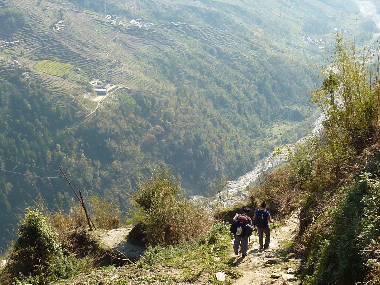
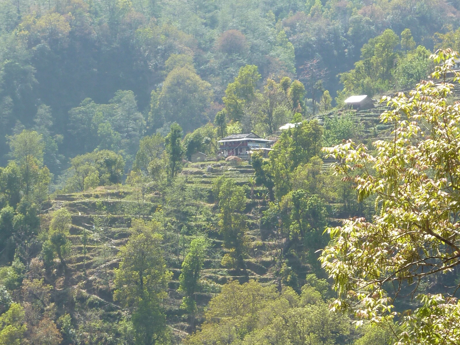
The trail wound down through vast valleys where we walked amidst crops of barley, wheat, and potatoes. Every piece of farm land is terraced here – otherwise the pitch of the land would be far to steep to farm.
We descended thousands upon thousands of rock steps before dropping down to the river.
It seems goofy, but after walking so much each day you kind of engage autopilot mode and things just happen. It seems as though your feet put themselves where they need to be without any conscious effort or thought. Almost robotic.
I actually ask often “How many kilometres are we doing today?” and no one ever knows. Someone said to me kilometres are meaningless here because nothing is straight. Every path is zig zagging, climbing, falling – everything but straight. Instead they use hours. “4 hours to the next village”. Seems to be much more efficient.
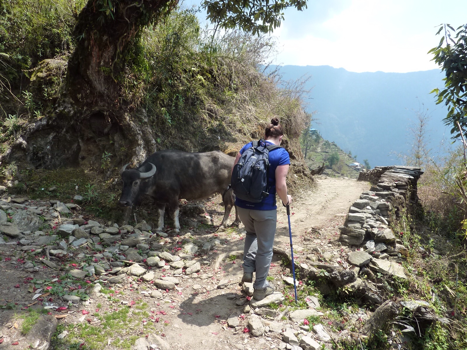
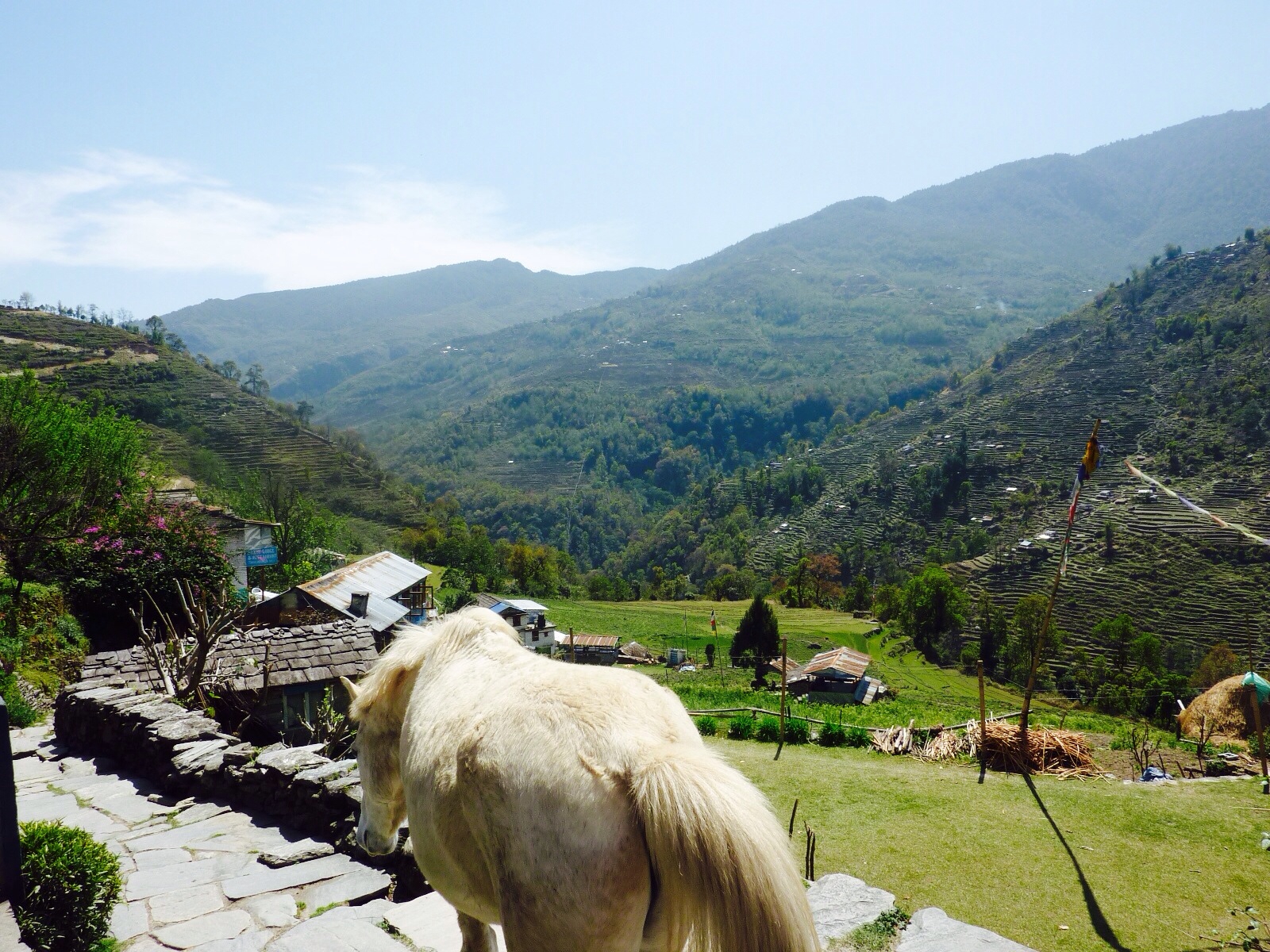
One of the things we have had to do lots of is dodging animals. Goats, donkeys, mules, horses, oxen, yak – everything uses the same path as we use so we have to share it with all sorts of animals.
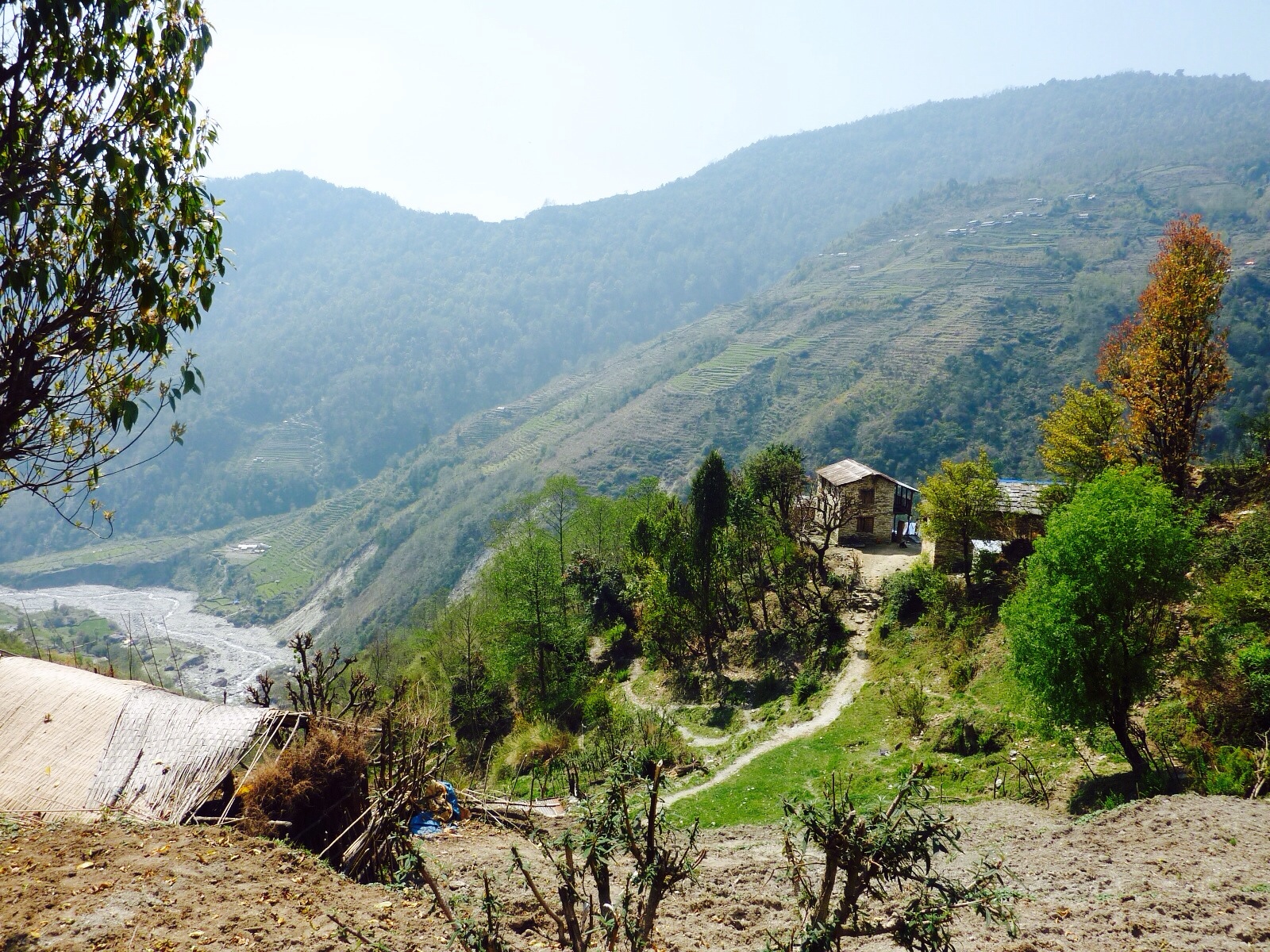
After 7 hours of trekking, we arrives in lower Sinewa where we will be staying the night. We fell in love with this little place. Cozy tea house, great food, fair prices, great view:
View from our room
We spent the evening teaching our guide Lal some new card games and drinking hot drinks. Tomorrow we start to get into much higher altitude, which means colder temperatures as well. Both of us feel that we have adapted to the rigours of trekking in the Himalayas. Days are getting much easier to cope with and even though our legs feel drained, we both feel mentally stronger which is important when the gas tank is running on empty. Eye of the tiger.
Side note: The original title of this blog was “Sore Feet and Proud Smiles”. Megan suggested I make the adjustment.
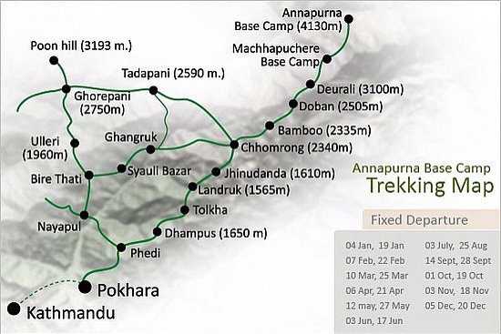
Currently we are sitting at 2860 meters above sea level in a guesthouse that is literally built into the side of a mountain. Our legs are aching, our shirts are dripping with sweat, but we are proud to be done the first two (of ten) days of the ABC trek (Annapurna Base Camp). I am typing this blog from the small village of Ghorepani and unbelievably they have wifi here. Hard to believe. Meg and I are currently enjoying a pot of post-hike hot lemon tea while checking out the view from our guesthouse: “Super View Guesthouse”.
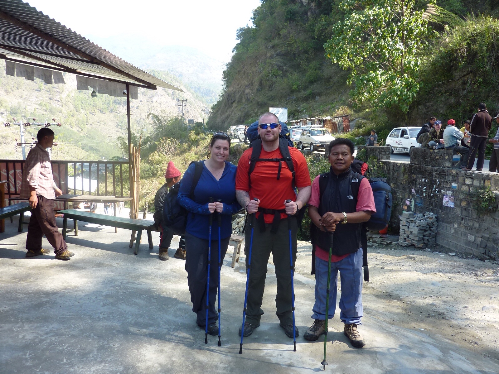
After interviewing a couple different potential trekking guides, Megan and I decided on a man named “Lal”. Lal was a true veteran of the mountains. At 44 years old he had done the 10 day ABC trek over 100 times! He was originally born in the surrounding Annapurna mountains and has been guiding and portering for 17 years. Lal stood about about 5'3″ tall, had darker skin than most Nepalis, and a big round face that revealed a huge white toothed smile. We felt comfortable with him and hired him only minutes after meeting him.
Lal
After cramming our belongings into my backpack, we were all prepped for the trip. Most people doing this trek hire a porter to pack their backpack for them. To me this is cheating. A lot of people will argue that by hiring a porter, you help the Nepali economy. That may be true but how could I let someone that is nearly a foot shorter than me and 80lbs less than me pack my backpack for me? I would feel like such a wuss. The taxi arrived early in the morning to take us to the starting point for our trek (a 1.5 hour drive). The owner of our guesthouse looked puzzled when I loaded my big 80L Arcteryx backpack into the taxi. 40 lbs was a big load on a hike like this.
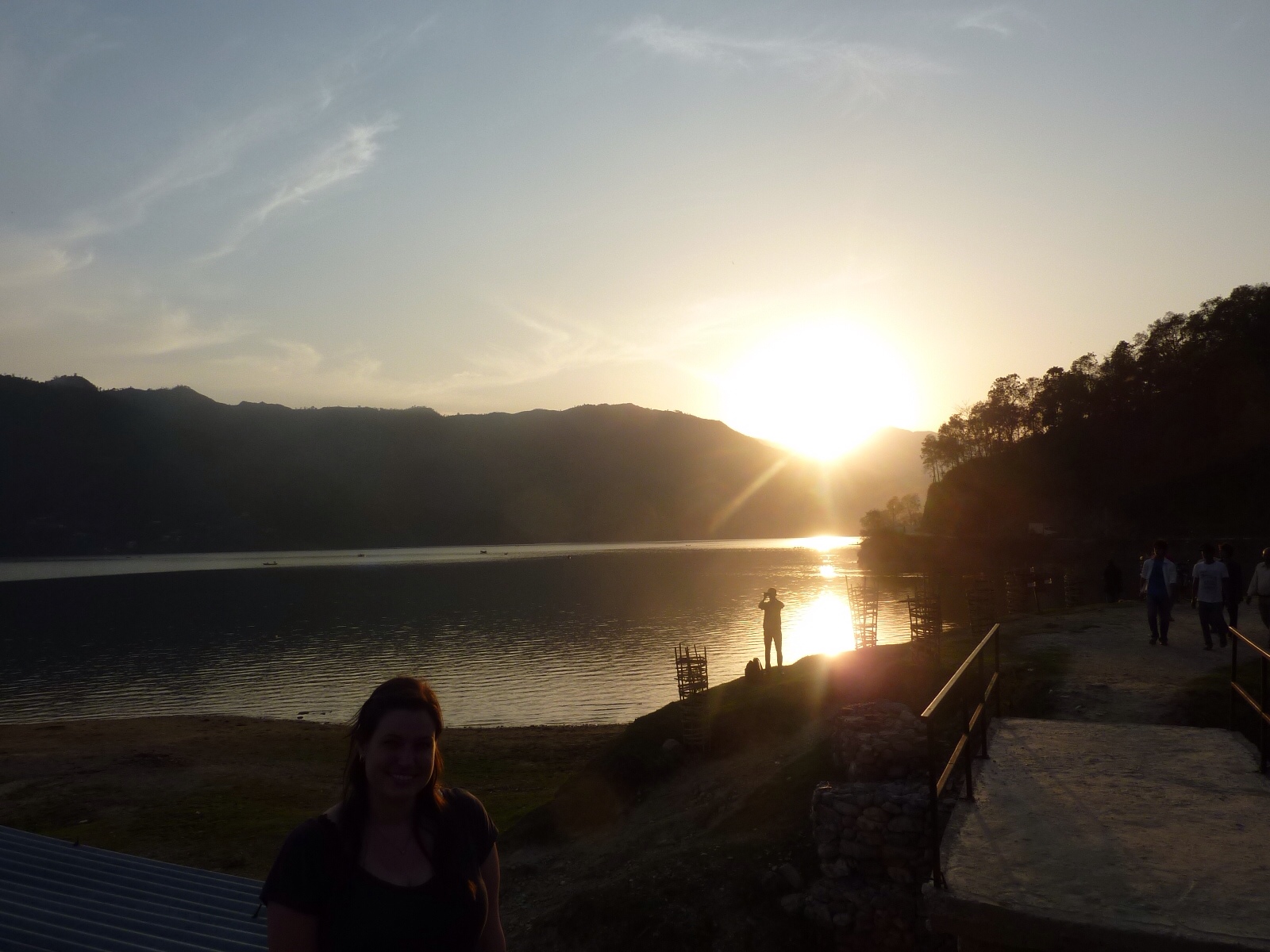
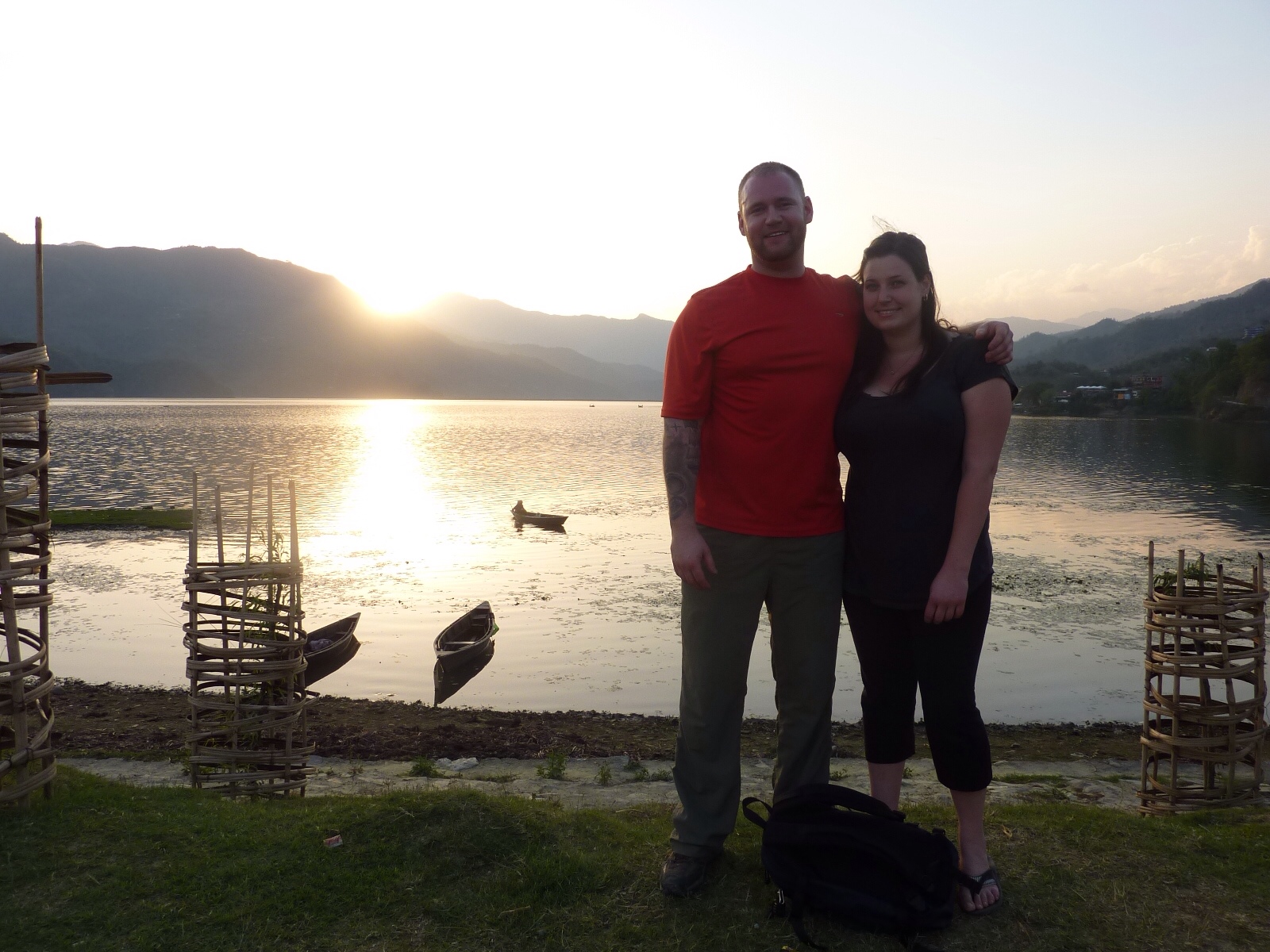
In a few short minutes; Lal, Megan, and I departed in the taxi from Lakeside city of Pokhara:
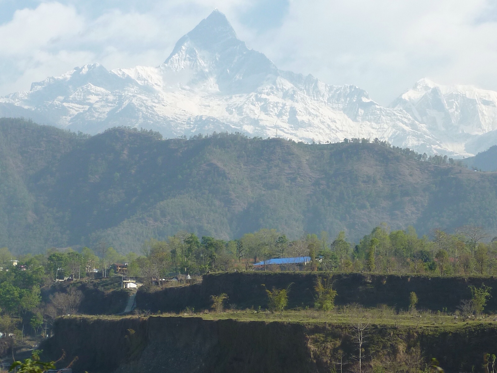
Our taxi wound through the Nepali hills revealing two snow capped Mountains in the distance. Lal leaned back from the front passengers seat and said with a smile “those mountains are called Annapurna 1 and Machhapuchhre”. Seemed impossible. How could we get to the base camp of Annapurna 1 when it seems so impossibly far away. What did we get ourselves into. At that moment, I zoomed in as far as my camera would go and snapped a picture:
Megan began to get nervous, shifting from side to side in her seat. I didn't have to ask what she was thinking at that moment. The taxi came to a stop on a dirt road near a small village called Nayapul. We opened the hatchback, grabbed our bags, paid the driver, and he sped off in a cloud of dust.
After Lal presented our trekking permits to the park authorities, we started off our trek:
Day 1 (Nayapul to Ulleri)
Starting elevation: 1070m
The start
We started our hike passing through the small village of Nayapul, then following a winding river through a green, lush valley until we reached the second village of Birethani:
After showing our permits for a second time, we continued to follow the river Northwest, losing sight of the mountains. Occasionally a Jeep would pass us kicking up dust and forcing us to the side of the road. The sun felt hotter than usual, almost to the point where it wore us down more than the actual trekking did. This forced us to drink litres and litres of water, filling up our water bottles from outdoor taps located near local villages. We passed by terraced rice fields where farmers farmed steep swathes of land:
Overall the trekking was surprisingly easy, with little altitude change. In 3 short hours we had reached our lunch destination, a few houses lumped together called “Sudame”. After a quick meal of muesli for me and veg fried rice for Meg, we continued our trek. We passed by more rice fields and over rope bridges, dodging oxen, donkeys, and goats along the way. In another 1.5 hours, we found ourselves at the village of Tikhedhungga. We had planned on staying at Tikkhedhungga for the night, but Megan insisted that we push on to the next village of Ulleri. “How far to Ulleri?” we asked Lal. He pointed to the top of the mountain across the river valley. Meg got her way. We crossed the river and started up the mountain.
This is when things changed. Big time. We had been told earlier about an area where we would have to climb 3280 rock steps – this was the start of that. My 40lb backpack began to feel heavier every 15 minutes as we trudged up the steps at a snails pace. Our quads and calves started burning more with each step. We were forced to stop for water breaks every 20 minutes. The sun compounded the exhaustion. This may seem like exaggeration, but I have done some very difficult hikes and this day was as hard as any that I have faced. I asked Megan for a piece of chocolate that she was storing in her small backpack. She refused – saying that the chocolate should only be used as a reward when we finish our hike. Ugh.
Megan
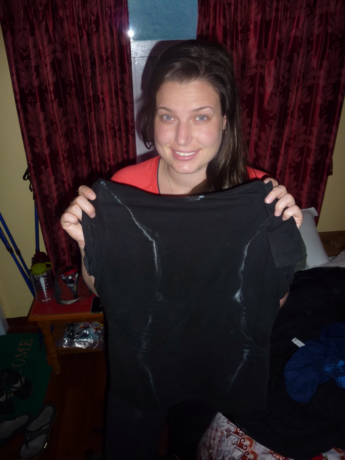
It was a brutal few hours. Megan did great – she basically willed herself up the mountain. The gas tank was empty. At one point Lal offered to switch packs to give my legs a short break (his pack weighed only 10-15 kilos). I accepted. We continued to climb in altitude until the village of Ulleri was visible. As quickly as we could, we checked into a guesthouse, showered, ate, hung up our sweat stained t-shirts, and did some quick stretches before heading to bed.
Sweaty shirt
Total hours of trekking: 6.5 hours
Day 2 (Ulleri to Ghorepani)
Starting elevation: 1960m
We woke up early the next morning to the sound of a farmer moving his donkeys through the village. Each donkey had a bell around its neck which made it sound like an awful symphony of clanging bells.
We were pleasantly surprised in the morning to find that our legs were not completely seized up from the beating they took the day before. We paid our bill at the guesthouse, had a hot breakfast, and set out at 7:45am.
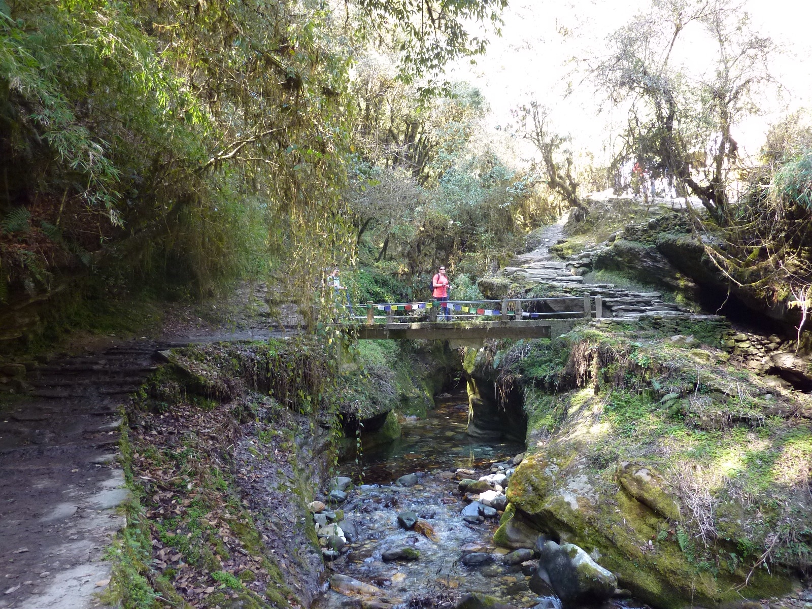
The rock steps continued upwards, zig zagging up the mountain and revealing some excellent views of snow capped mountains. Before long, the scenery changed and we found ourselves walking through a beautiful green forest passing over bridges.
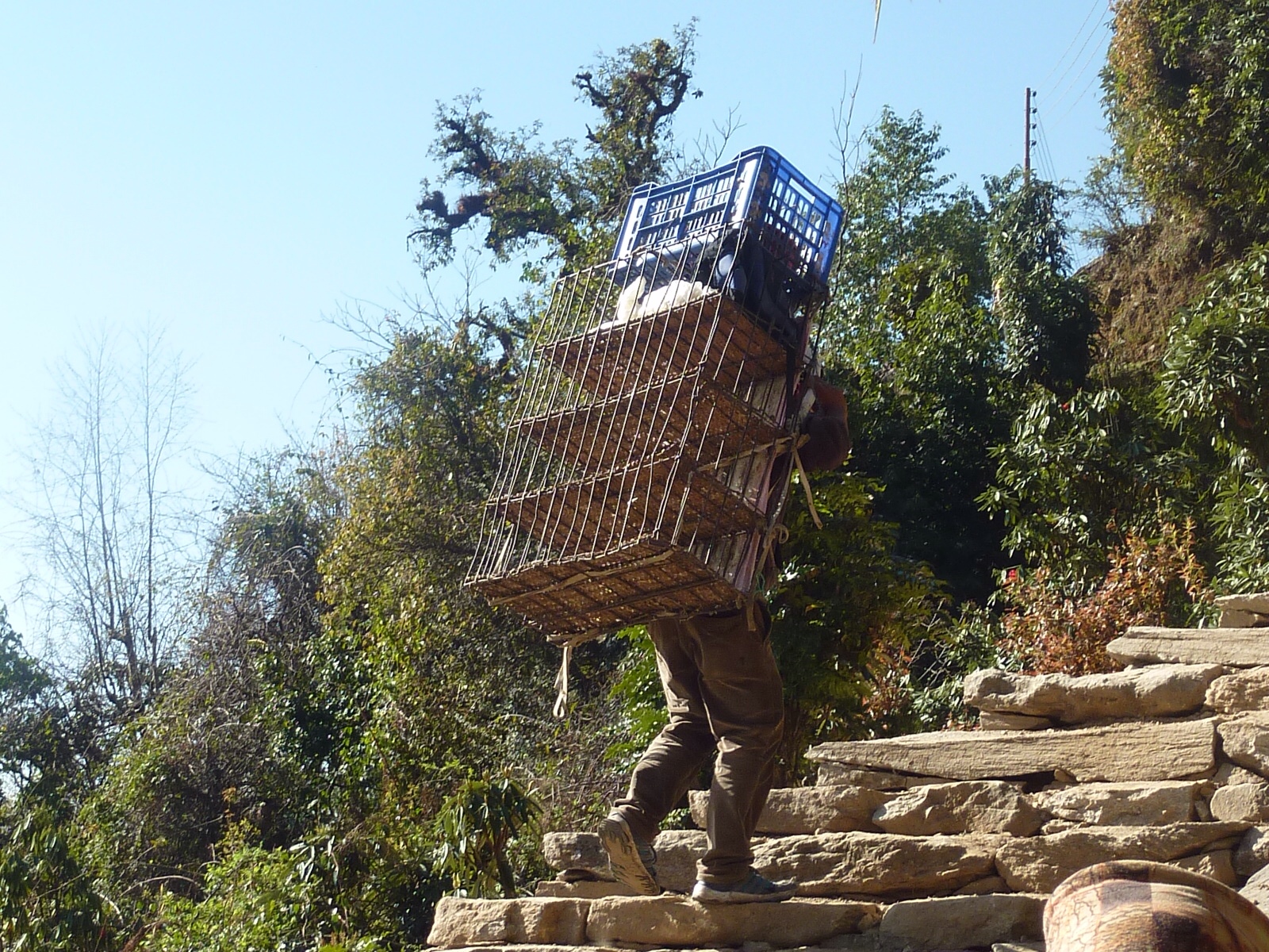
At one point we passed a couple of porters packing a cages of chickens on their backs.
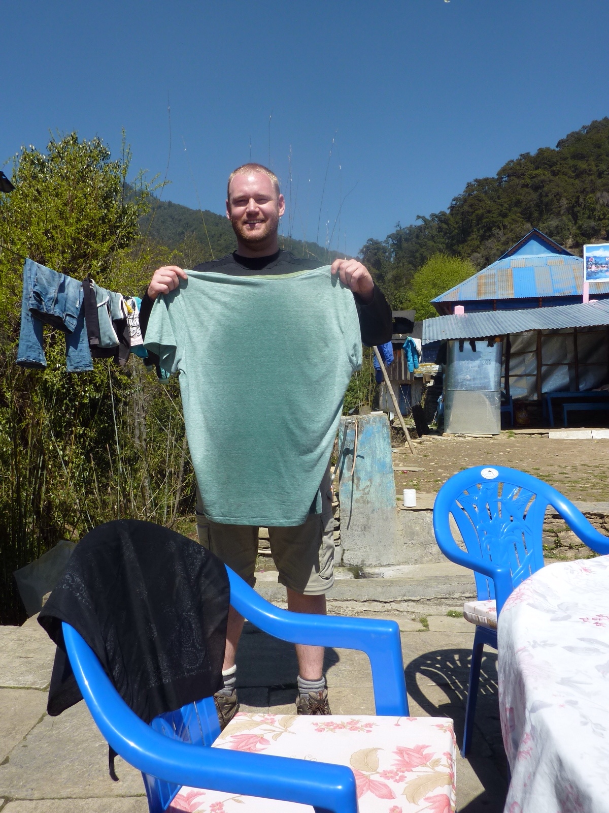
A couple of hours later we reached a village called Naya Thanti where stopped to have a quick bite to eat and to air out our sweaty t-shirts.
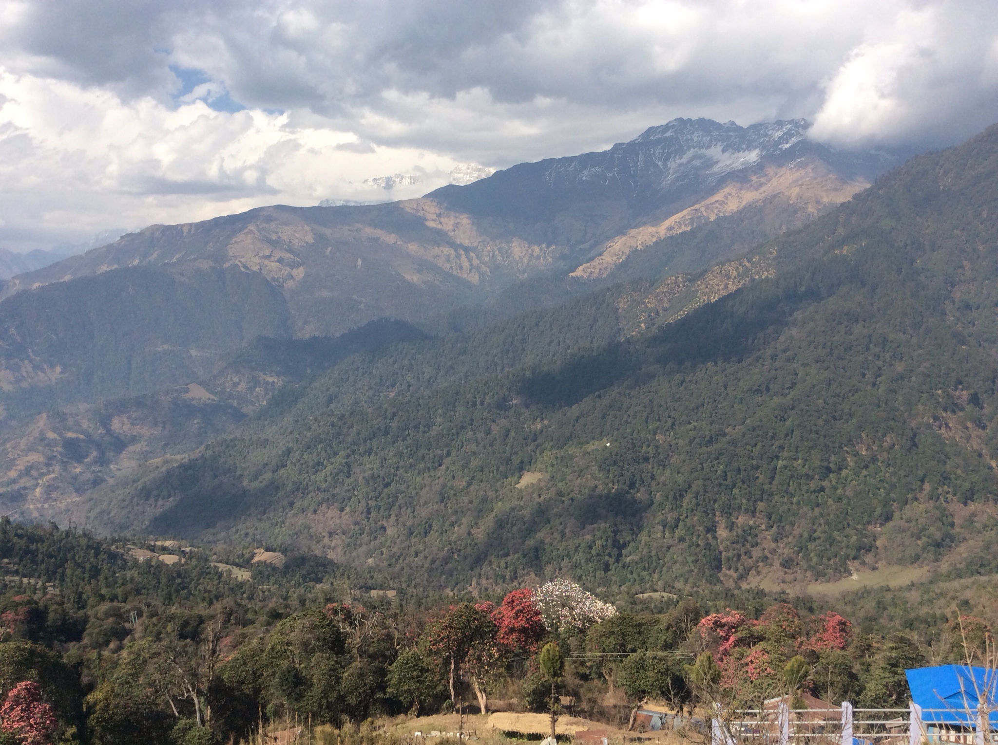
After lunch, the path became considerably easier. Blooming rhododendron flowers began to appear, scattered out along the trail.
Again, we started climbing sharply, gaining altitude with every step. Those damn rock steps appeared again making our legs ache with each step. After another hour or so, we reached our destination of Ghorepani where we were blown away by the view of the valley and surrounding mountains.
This was a difficult day but it didn't compare to the first day.
Total hours of trekking: 5 hours
That pretty much catches you up on what we've been doing. And now you know
The rest of the story
Again, how insane is it that we have wifi here in the middle of nowhere?